

The quest for hidden treasures has captivated the imagination of adventurers and historians alike for centuries. The art of identifying treasure sites often begins with the analysis of maps that hold essential clues to the past. Whether it’s ancient cartographic documents or modern topographical representations, these maps serve as valuable resources in the pursuit of lost artifacts and buried fortunes.
In this article, we will explore various techniques utilized by treasure hunters to decode the secrets embedded in maps. From the interpretation of symbols and legends to the assessment of geographical features, each map contains critical clues that can lead to significant discoveries. Understanding how to read these maps and apply related strategies can make the difference between a fruitless search and a rewarding expedition.
Furthermore, we will delve into the technological advancements that enhance our ability to identify potential treasure sites. Modern tools, such as Geographic Information Systems (GIS) and satellite imagery, provide treasure hunters with unprecedented access to maps and data. As we blend traditional techniques with innovative technology, the search for hidden treasures becomes not only an exciting adventure but also a science rooted in the interpretation of clues found on ancient maps.
Analyzing Historical Maps for Hidden Locations
Historical maps serve as invaluable resources for treasure hunters and researchers seeking hidden locations. These maps often contain clues that can lead to buried artifacts or lost treasures. To effectively analyze these documents, one must pay attention to various elements embedded within the cartographic representation.
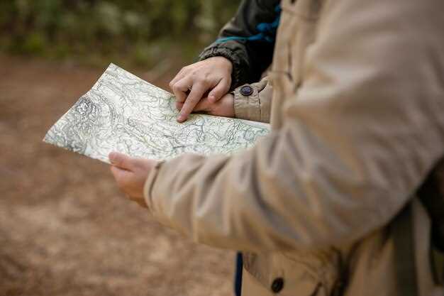
First, examine the geographical features depicted on the maps. Mountains, rivers, and valleys can indicate specific sites where treasures may have been concealed. Comparing these features with current topographical data can highlight changes over time, which may reveal long-forgotten paths or landmarks crucial in the search for hidden treasures.
Next, consider the notations and symbols used on historical maps. These markings often provide hints about historical events, ownership disputes, or treasure legends. Understanding the context behind these symbols can unlock significant insights. Additionally, look for unusual markings that could signify hidden routes or entry points to secret locations.
Another essential aspect is the time period the map represents. Different eras had distinct geographical knowledge and mapping techniques. By studying maps from the same time frame, you can identify patterns or recurring locations that may have been significant in the past. This comparative analysis can yield potential sites worth investigating.
Cross-referencing historical maps with archival documents, journals, and oral histories can further bolster your findings. These texts may provide additional clues regarding the intentions of mapmakers and the historical events that shaped the areas in question. Collaboration with historians or archaeologists can also enhance the interpretation of these findings.
Ultimately, the art of analyzing historical maps requires a keen eye and an understanding of both the cartographic techniques of the time and the historical context of the content. By meticulously examining these maps, treasure hunters can uncover hidden locations that have remained undiscovered for centuries.
Decoding Symbols and Markings on Treasure Maps
Treasure maps are often filled with clues that indicate the location of hidden riches. Understanding the symbols and markings used on these maps is crucial for treasure hunters aiming to uncover their long-lost fortunes. Each element depicted on a map can hold significant meaning, whether it’s indicative of geographic features or specific instructions.
Common symbols include X marks the spot, which typically denotes the treasure’s exact location. Surrounding this prominent mark may be other symbols like trees, mountains, or bodies of water, which help in triangulating the treasure’s position. For example, a river may signify a route to approach, while a nearby cave or rock formation might provide clues about how to access the treasure.
Another vital aspect is the use of compass markings, indicating directions that can lead to the treasure. North, South, East, and West symbols often serve as guides, directing treasure hunters to navigate effectively through unfamiliar terrain. Understanding cardinal directions is essential, as misreading these can lead one astray, away from the coveted treasure.
In addition to geographic indicators, some maps feature cryptic codes or numerical clues. These might require decryption, revealing distances, dates, or instructions that are vital to locating the treasure. It is essential to keep an open mind when interpreting these codes, as historical context and the background of the map’s creator can deeply influence the clues embedded within.
Furthermore, the condition and age of a map can also affect its readability. Maps that have aged may have faded symbols or illegible text that requires careful examination. Utilizing tools such as magnifying glasses or digital enhancements can help uncover hidden markings that could lead to significant discoveries.
Ultimately, decoding symbols and markings on treasure maps is a complex yet rewarding task. With careful analysis and an understanding of the various elements involved, treasure hunters can piece together the clues that lead to their ultimate goal–a hidden treasure.
Utilizing GPS and Geolocation Tools in Treasure Hunting
In the modern age of treasure hunting, GPS and geolocation tools have revolutionized the way enthusiasts approach their quests. These technologies allow hunters to navigate remote areas with precision, increasing the chances of discovering hidden treasures.
One of the primary advantages of GPS devices is their ability to provide accurate coordinates. By marking specific locations on maps, treasure seekers can document where they have explored and where potential clues have led them. This systematic approach minimizes the risk of overlooking valuable clues that could guide their search.
Geolocation tools also enhance the way treasure hunters interact with maps. Many applications allow users to overlay historical maps with current geospatial data. This not only helps in identifying changes in terrain but also reveals how landscapes might have shifted over time, potentially covering or exposing treasure sites.
Using these tools, hunters can efficiently plan their routes, ensuring they maximize their time spent searching. By inputting waypoints related to possible clue locations, they can navigate complex terrains without losing sight of their objectives. Safety is also a crucial consideration; GPS devices help track movements, particularly in unfamiliar areas.
Additionally, mobile applications equipped with geolocation features can record and share findings in real-time with other hunters. This collaborative approach fosters a community that can pool resources and knowledge, enhancing everyone’s prospects for uncovering hidden treasures.
Ultimately, integrating GPS and geolocation technology into treasure hunting strategies not only streamlines navigation but also offers a systematic method for interpreting maps and uncovering clues. As technology continues to advance, these tools will undoubtedly play an increasingly vital role in the quest for hidden bounty.
Connecting Clues from Local Legends and Folklore
Local legends and folklore often contain valuable clues that can lead to hidden treasure sites. These stories, passed down through generations, frequently feature specific locations, events, or characters tied to the treasures. By analyzing these narratives, treasure hunters can uncover map markers and geographic hints that traditional maps may not highlight.
Many folk tales describe secret hideouts or landmarks associated with legendary figures, such as pirates or outlaws. These figures are often said to have buried their loot in places that hold historical significance or align with natural features. Identifying these features on contemporary maps is crucial, as they may provide essential starting points in the treasure search.
Moreover, certain patterns in the folklore can indicate the presence of natural elements such as rivers, hills, or caves that could shelter hidden treasures. By cross-referencing these locations with old maps or historical records, treasure seekers can create a detailed picture of where to look. These connections between legends and cartographic data can become the key to unlocking possible treasure sites.
Incorporating local legends into treasure-hunting strategies not only enriches the search but also fosters a deeper appreciation for the history and culture of the area. Each story offers a unique perspective, making the pursuit of treasure an adventure filled with narrative and discovery.
Employing Aerial Imagery for Site Identification

Aerial imagery has become an essential tool in the search for treasure sites, providing unique clues that are not always visible from the ground. This method allows researchers and treasure hunters to analyze large areas in detail, revealing potential locations of historical significance. By examining aerial maps, one can identify anomalies in vegetation, alterations in terrain, and other indicators that suggest human activity or buried artifacts.
One of the primary advantages of aerial imagery is its ability to reveal subtle features that traditional ground surveying might miss. For example, changes in soil color or crop health observed from the air can indicate underlying structures or disturbances. These clues, when correlated with historical maps and records, can significantly narrow down potential treasure sites.
Furthermore, aerial imagery can be combined with other technologies, such as Geographic Information Systems (GIS), which allows for the layering of various data sets. By integrating historical maps with modern aerial photographs, researchers can create a comprehensive view of an area, facilitating more accurate assessments of where to conduct further exploration.
In addition, the time-lapse capabilities of aerial imagery enable the monitoring of landscape changes over time. This can provide insights into how the environment has evolved and how these changes may have affected the preservation of treasure sites. By identifying patterns in the landscape, treasure hunters can better predict where to find hidden treasures.
In conclusion, employing aerial imagery alongside traditional maps offers a powerful approach to refining the search for treasure sites. The visible clues from aerial views can lead to more informed decisions and productive explorations in the quest for hidden riches.
Formulating Search Strategies Based on Map Evidence
When it comes to locating hidden treasures, understanding and leveraging the information presented on maps is paramount. Maps can provide valuable clues that, when interpreted correctly, can lead treasure hunters to their ultimate goal. The following strategies outline how to effectively utilize map evidence to formulate a successful search plan.
- Analyze Historical Context
- Research the history of the area depicted on the map. Understand when the map was created and the events that occurred during that time.
- Study local legends or folklore that may hint at treasure locations.
- Identify Key Landmarks
- Look for notable geographical features such as rivers, mountains, or caves that may be referenced as landmarks in your search.
- Cross-reference these features with existing literature to identify any potential treasure sites.
- Use Scale and Topography
- Pay attention to the scale of the map to understand distances accurately; small distances on a map can represent significant physical challenges.
- Assess the topography for obstacles like cliffs or thick vegetation that can affect accessibility to the treasure site.
- Overlay Techniques
- Utilize modern technology by overlaying old maps with current satellite images to identify changes in the landscape.
- Combine multiple maps from different periods to look for inconsistencies that may suggest hidden or lost treasures.
- Engage with Local Experts
- Consult with historians or local treasure hunting groups who might have valuable insights or additional map evidence.
- Participate in community events or forums to share knowledge and gather more information about treasure sites.
By systematically applying these strategies based on map evidence, treasure hunters can enhance their chances of discovering hidden treasures. The interplay of historical data, landscape features, and modern technology contributes to a well-rounded search approach that maximizes the potential for success.


